Routing
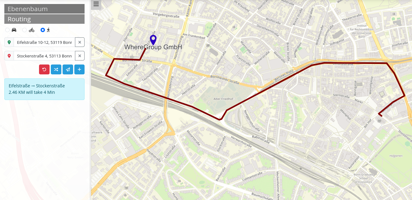
The routing element adds a routing tool to an application. After specifying the start, destination and any intermediate points, a suitable route is displayed on the map. Information about the route can also be displayed.

Configuration

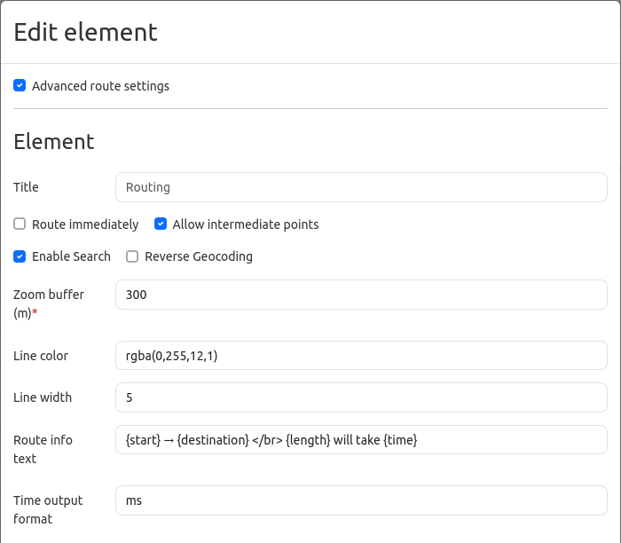
Advanced route settings: Allows you to make further settings (default: false).
Title: Elements Title.
Route immediately: Configuration to deactivate/activate automatic routing without the users interaction (default: false).
Allow intermediate points: Configuration for deactivating/activating intermediate points (default: false).
Enable Search: Configuration to deactivate/activate the search option (default: false).
Allow export: Configuration to deactivate/activate the export of the route (default: false).
Zoom buffer (m): Definition of a zoom buffer for the result display in meters (default: 0).
Line color: Option to adjust the line color and opacity with the rgba standard (default: rgba(66, 134, 244, 1)).
Line width: Option to adjust the line width (default: 3).
Route info text: Option to add an info text for the rout (default: {start} → {destination} </br> {length} will take {time}).
Path start icon: Customize the start icon (default: /bundles/mapbenderrouting/image/start.png).
Path intermediate icon: Customize the intermediate icon (default: /bundles/mapbenderrouting/image/intermediate.png):
Path destination icon: Customize the destination icon (default: /bundles/mapbenderrouting/image/destination.png).
Size Icon: Adjust the size of the different icons.
Offset Icon: Adjust the offset of the different icons.

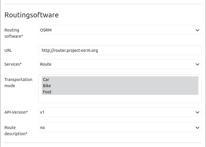
Routing software: Select the routing software (OSRM).
URL: Set the URL address for the routing software or choose a variable, e.g. https://routing.openstreetmap.de/routed-%profile (default: https://).
Services: Select from various services (defaut: Route).
Transportation mode: Select the routing profiles (car, bicycle, pedestrian). It is also possible to select more than one (default: none).
API-Version: Determine the version of the API (default: v1).
Route description: Select whether there should be a route description or not (default: no).
Attribution: Provide a source reference (default: Take a look at the screenshot above).

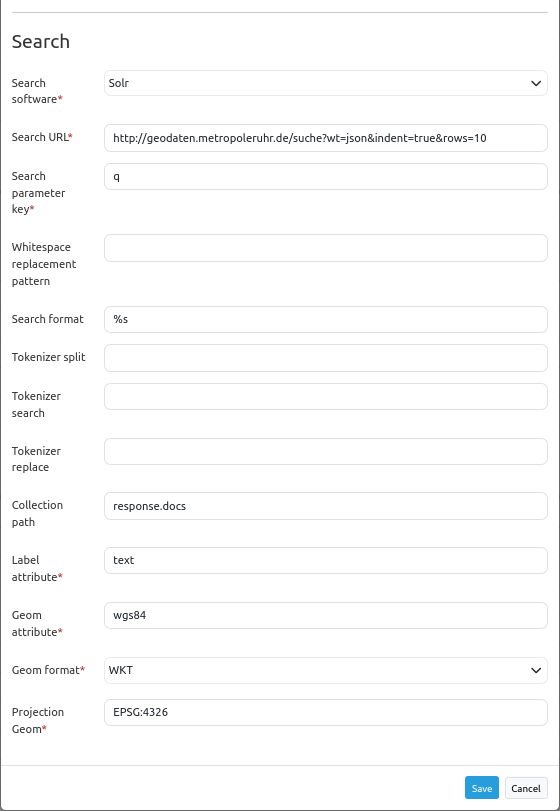
Search software: Select the search service (default: Solr).
Search URL: Set the URL address for the search software.
Search parameter key: Set the search parameter key (default: q).
Whitespace replacement pattern: Set parameters to replace the search term.
Search format: Set the search format (default: %s).
- Token split/search/replace (JavaScript regex): Tokenizer splits/searches/replaces regexp.
Token split, z.B.:
[^a-zA-Z0-9äöüÄÖÜß]Token search, z.B..:
([a-zA-ZäöüÄÖÜß]{3,})Token replace, z.B..:
$1*
Collection path: Set the attribute path that is extracted from the query result (default: response.docs).
Label attribute: Name of the attribute’s to show as result (default: label).
Geom attribute: Name of the geometry attribute (default: geom).
Geom format: Geometry data format, can be WKT or GeoJSON (default. WKT).
Projection Geom: EPSG code of the spatial reference system(default EPSG:4326).